Before the Sky Becomes the Footpath: The Missing Civic Layer in Advanced Air Mobility
The Drone and Advanced Air Mobility Industry is rapidly solving certification, detect-and-avoid, digital traffic management and the interfaces with conventional ATM. But if the forecasts materialise, the harder question may be whether cities can live underneath it.
There is an interesting lesson for aviation currently lying on footpaths across London, Sydney, Melbourne, Adelaide, Brisbane and probably a city near you.
The 15-minute city, and its less ambitious 30-minute cousin, are built around an attractive idea: organise communities so everyday needs can be reached without dependence on a private car. Walking, cycling and micromobility fit naturally into that vision, and the electrically assisted bicycle ought to be almost the perfect technology for it.
Then reality intervened.
By late 2024, around 40,000 dockless e-bikes were operating across 22 London boroughs. Yet Transport for London and the boroughs lacked adequate powers to manage the schemes. Poorly parked bikes blocked footpaths and impaired accessibility, leaving government seeking stronger statutory powers after the operating model had already spread.
It’s raised to a dangerous level in Australia with “ride-outs” by uncontrolled youth blocking major thoroughfares like the iconic Sydney Harbour Bridge. But the e-bike did not fail.
The governance model (or lack of one) arrived after the technology.
Aviation should pay attention, because drones and Advanced Air Mobility could repeat that sequence several hundred feet higher and at a scale that makes abandoned bicycles or disruptive ride-outs look quaint.
Scale changes everything
For much of the past decade, drones and AAM have inhabited the comfortable world of demonstrations, trials and individually approved operations. A handful of demonstration flights is manageable. A few hundred movements every day over the same neighbourhood are something else entirely.
Airservices Australia, Australia’s ANSP, forecasts annual drone flights increasing from around 1.5 million in 2023 to 60.4 million by 2043. Britain’s Civil Aviation Authority has cited a forecast of 321 eVTOLs operating 1.1 million UK flights annually by 2030, increasing to 6,500 aircraft and 58.8 million flights a year across the UK’s 18 largest cities by 2050.
The studies use different assumptions, but the order of magnitude matters. The industry is discussing millions and tens of millions of movements.
For comparison, the six principal London-area airports recorded 1,154,473 aircraft movements in 2025. Sydney Kingsford Smith recorded 321,916 movements in the 2025 financial year and nearby Bankstown another 218,046. Even allowing for the differences between conventional aircraft movements and short-duration drone flights, the contrast is sobering. These numbers also exposes a weakness in one of the industry’s favourite words: integration.
The dangerous comfort of “integration”
Almost every AAM strategy promises integration. Drones will be integrated into airspace. eVTOLs will be integrated with conventional traffic. UTM will integrate with ATM.
It sounds reassuring, but the word has become elastic enough to hide very different concepts.
In conventional terminology, integrated airspace concerns the ability of different users to coexist and interact safely within the wider aviation system. That remains essential. An AAM aircraft approaching a major airport, a drone crossing controlled airspace, or an emergency UAS operation may need interfaces with conventional ATS and crewed aviation.
That is not the same thing as trying to absorb millions of routine low-level drone and AAM movements into conventional ATM.
Here, fully managed sky means something different: the drone/AAM operating environment itself a digitally managed ecosystem in which legitimate operations are known, authorised, strategically deconflicted and monitored against declared intent.
A fully managed sky should not be confused with integrated airspace. They touch one another, but they are not synonyms.
The points where the two environments meet may be comparatively few: an AAM aircraft transitioning into terminal airspace, a UAS corridor intersecting a conventional route, an emergency operation receiving priority, or a conventional aircraft entering the low-altitude environment unexpectedly. Those interfaces need rigorous standards and information exchange. They do not require every suburban delivery flight to become another movement for ATC to tactically separate.
The challenge is managed interoperability, not universal tactical mixing.
The distinction leads to what may be the most important architectural proposition in the whole debate:
We do not need to integrate millions of drone and AAM movements into conventional ATM. We need to manage them within their own scalable operating architecture, and integrate that architecture with conventional ATM wherever the two need to interact.
Manage intent, not encounters
Conventional aviation has already spent years developing the intellectual logic required.
Trajectory Based Operations moves ATM away from an overwhelmingly tactical model towards one in which the intended four-dimensional trajectory — latitude, longitude, altitude and time — becomes a common organising object.
Know the intent. Share the intent. Identify conflicts early. Resolve as much as possible strategically. Intervene tactically when reality departs from the plan.
If two drone trajectories occupy the same volume at the same time and that conflict is visible twenty minutes beforehand, perhaps one departure moves by thirty seconds. If both aircraft are allowed to continue until their onboard systems must evade, the network has consumed far more safety margin, energy, airspace and uncertainty to solve a problem already visible in the data.
DAA cannot become air traffic control by another name
Detect-and-Avoid is indispensable, but it needs to occupy the correct place in the architecture.
DAA enables an aircraft, or supporting system, to detect traffic or hazards and take action to remain clear or avoid collision. It is critical to BVLOS operations and particularly valuable where unexpected traffic enters the operating environment.
But tactical DAA cannot become the normal mechanism by which a mature high-density network organises itself.
Strategic deconfliction exists to arrange operational intent — trajectories, volumes, routes or time assignments — so conflicts are unlikely to arise. Tactical deconfliction is what is required when the strategic layer fails, degrades or is overtaken by events.
Every tactical manoeuvre also creates a new trajectory, potentially creating another conflict. At high density, a network depending principally on reactive avoidance risks becoming less like a transport system and more like an exceptionally sophisticated flock of startled birds.
DAA is the safety net for uncertainty, non-conformance and the unforeseen.
If routine DAA manoeuvring is what keeps a high-density urban network apart, the traffic-management system has failed.
A different CNS/ATM architecture
This is why UAS Traffic Management should not simply be described as “ATC for drones”.
The emerging model is more digital, distributed and automated. Europe’s U-space already requires services including flight authorisation, geo-awareness, network identification and traffic information. Australia’s Airservices is developing its Flight Information Management System, or FIMS, through approved UAS Service Suppliers.
Communications will be predominantly machine-to-machine. Navigation will depend heavily on assured positioning and trajectory conformance. Surveillance will combine cooperative and non-cooperative sources. Traffic management will have to be highly automated because humans cannot tactically control millions of movements.
ADS-B illustrates the problem of simply extending conventional technologies. It transformed cooperative surveillance, but that does not mean every small drone can simply be added to the same architecture. Remote ID reflects the need for identification mechanisms designed for far denser populations.
Knowing an aircraft exists is surveillance.
Knowing who it is, is identification.
Knowing where it intends to be is trajectory information.
Ensuring another aircraft has not been planned through the same place at the same time is traffic management.
Avoiding it at close range when something has gone wrong is DAA.
The security dividend of a fully managed sky
A fully managed drone/AAM sky can also reduce security risk, not because it eliminates bad actors, but because it shrinks the unknown.
A mature low-altitude environment will contain navigation errors, lost links, technical failures, unauthorised operations and, inevitably, aircraft used for nefarious purposes. Counter-UAS therefore has to determine what an observed aircraft is, whether it should be there and whether intervention is justified.
This is where the managed-sky concept overlaps with the counter-drone layer.
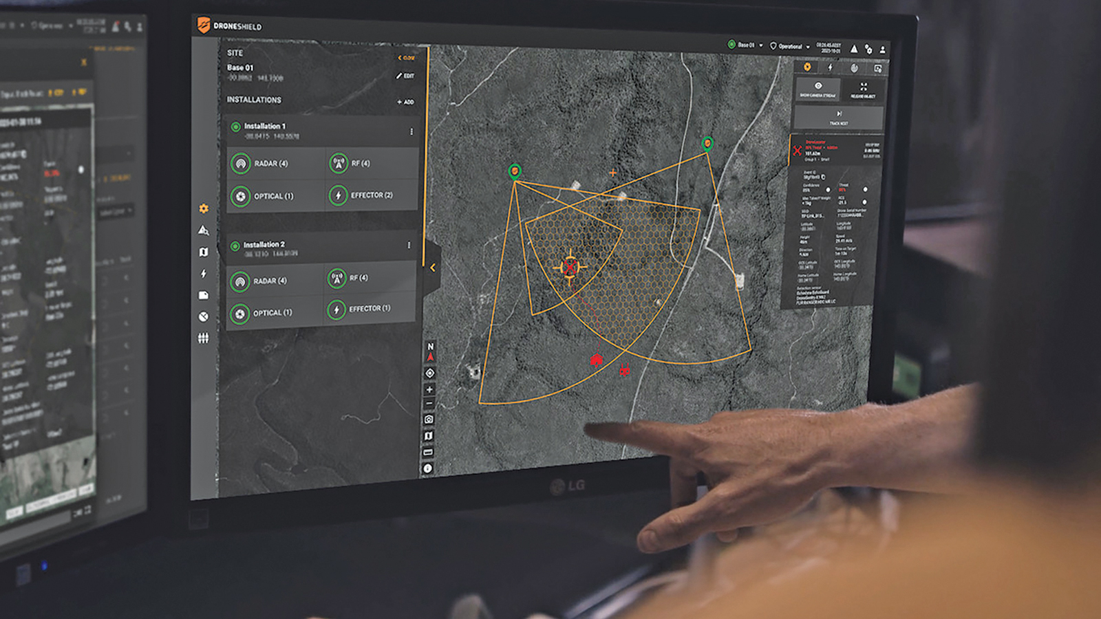
Andrew Kell, Product Manager at DroneShield, sees value in the additional context a managed sky could provide. As drone and AAM activity increases, he says, “having greater situational awareness across the air domain will be increasingly important”. A managed-sky environment in which legitimate aircraft are known, authorised and operating as expected can provide context around what should be in the air and where.
If the great bulk of legitimate traffic is already known, authorised and knowingly conformant to declared intent, the unusual aircraft becomes more conspicuous. An aircraft appearing where no operation is expected matters. So does an authorised aircraft materially departing from its trajectory.
The managed sky has not proved malicious intent, and it does not replace radar, RF detection, electro-optical sensing or specialist counter-UAS systems. But nor should non-conformance automatically be treated as hostile.
DroneShield is clear on that point. Kell notes that “malicious, unauthorised or otherwise nefarious drones are unlikely to rely on cooperative identification systems.” In high-risk environments, operators cannot assume every aircraft will identify itself or comply with established rules. Independent detection and tracking therefore remain essential.
That qualification strengthens the managed-sky argument.
The value lies in combining a trusted picture of cooperative, authorised activity with independent detection of everything else. Kell describes the likely future as a layered approach covering cooperative and non-cooperative detections to provide a “unified and holistic airspace overview”.
In effect, the counter-drone layer gains a built-in early-warning advantage. Instead of beginning with a sky full of unexplained objects, security systems can correlate detections against a picture of what should be there and how authorised traffic should behave.
Kell puts the objective neatly: counter-UAS operators need to understand “what is normal, expected and authorised within a particular environment.” Information from managed-sky platforms can contribute to that understanding, while counter-UAS provides an independent layer of detection and assessment.
The key enabler is interoperability. Where systems can securely share accurate and timely information, Kell argues, security personnel can focus more effectively on genuinely anomalous or unauthorised activity.
So the relationship is not substitution. Done properly, the two systems are complementary. At sufficient maturity, the fully managed sky becomes part of the security architecture itself.
But even that leaves one crucial question unanswered.
Safe is not the same as acceptable
Suppose all of this works.
We know what the aircraft is, where it is going, that it has been strategically deconflicted, that it is conforming, and perhaps that it is legitimate and benign.
There remains another question:
Should that trajectory be there in the first place?
Not from an airworthiness, collision-risk or security perspective but from the perspective of the people underneath it.
Governments and industry have been talking about social licence for years. The Metrops white paper, Cities as the Missing Layer, identifies the structural problem: aviation safety and airspace are regulated nationally, while the impacts people experience; noise, privacy, visual amenity, time of day and compatibility with local land use, occur on the ground and are inherently local.
Recognition has been abundant.
Operational machinery has not.
Texas is beginning to demonstrate the consequence. Amazon Prime Air commenced drone delivery operations from Richardson in the Dallas metropolitan area in December 2025. Residents from Richardson, Garland and Plano have since organised through Quiet Skies TX to protest and agitate against repeated noise, privacy and neighbourhood overflight.
The aviation authority regulates the aircraft and airspace. The operator flies the mission. But Local government is left to deal with land use and the consequences of unhappy and annoyed residents.
Noise does not respect municipal boundaries. Nor does privacy, or visual amenity. Or public tolerance.
The aircraft may be safe, secure, authorised and conformant — and still be profoundly unwelcome.
The missing civic layer
This is the gap Metrops’ Argon was created to address.
Its proposition is not that councils should manage airspace. They should not. National regulators, ANSPs, UTM providers and operators should continue performing aviation functions.
Local government has a different role.
Metrops describes Argon as a civic layer through which councils define two-dimensional ground-level expectation zones: what people in a residential precinct, industrial area, school zone, hospital district, park or other place can reasonably expect in relation to noise, privacy, amenity and time of day. Those expectations can then become machine-readable rules for the traffic-management layer.
Argon does not plan trajectories or separate aircraft. It supplies local rules to the systems that do those jobs and provides a mechanism for monitoring whether what communities were told to expect is what they actually experienced.
The conceptual key is that impact is judged where it is felt, not merely where the aircraft flew.
A drone may remain over industrial land while its acoustic footprint reaches nearby homes. From an airspace perspective it may have complied perfectly. From a civic perspective a residential expectation may nevertheless have been breached.
That suggests another extension of trajectory management.
The future trajectory must not be assessed only against weather, capacity, airspace and other trajectories. It must also be assessed against structured information describing the reasonable expectations of communities beneath it.
The loop becomes:
community expectation > machine-readable constraint > trajectory planning > strategic deconfliction > operation > conformance monitoring > experienced impact > evidence > refined expectation.
Design the system while the map is still blank
There is a tendency in emerging aviation to postpone these questions until certification, regulation and economics are settled.
But that may be precisely backwards.
Once distribution centres are built, vertiports established, routes optimised and customers accustomed to a service, changing the pattern becomes expensive. Operators have capital invested. Residents have grievances. Governments have political ownership of decisions already made.
Setting expectations beforehand is cheaper. The Metrops white paper makes the same point: expectation-setting while operating patterns are still soft is easier than attempting to unwind them after they become established.
That’s the lesson from micromobility. E-bikes were not the mistake. Allowing the operating model to mature faster than the governance around it was.
AAM is still early enough to avoid repeating that error.
TBO teaches us to manage intent rather than wait for conflict. UTM and U-space provide the basis for scalable digital management. DAA protects against the tactical and unforeseen. Remote ID, ADS-B and other surveillance technologies contribute identification and situational awareness. Counter-UAS focuses on the aircraft that does not fit the expected picture.
The fully managed drone/AAM sky connects those layers.
Conventional ATM remains alongside it, with deliberate interfaces wherever the two operating environments need to interact.
And Metrops adds the information none of those aviation systems inherently possesses: what the people underneath consider reasonable.
Safe is not the same as secure.
Secure is not the same as acceptable.
A mature AAM ecosystem has to manage all three.
Metrops reduces the civic part of that argument to six words:
Airspace is federal. The noise isn’t.
The industry still has time to design that principle into the system rather than discover it through public backlash later.
Because the hardest constraint on mass low-altitude aviation may not be whether millions of aircraft can fly safely.
It may be whether millions of people still want them there.
By Michael Bryan